Bernard M’Mahon · Eleventh Edition
The American Gardener’s Calendar
1857PhiladelphiaMaps →
Regional atlas
Maps of the gardener’s country
National reference
The country, then and now
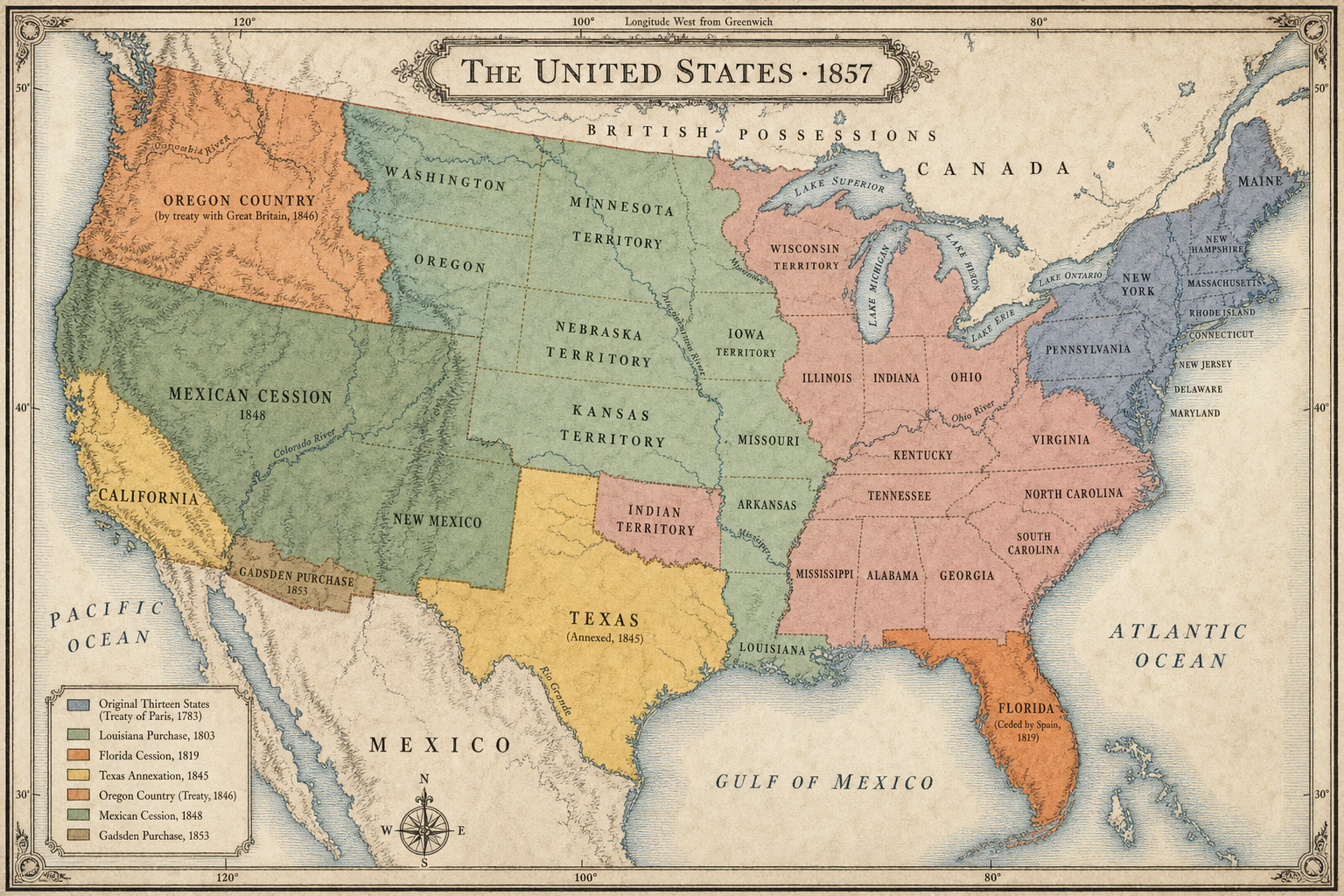
Open full image ↗ Historical national atlas
United States · 1857
A period-style view of states, territories, and the major land acquisitions that shaped the country by 1857.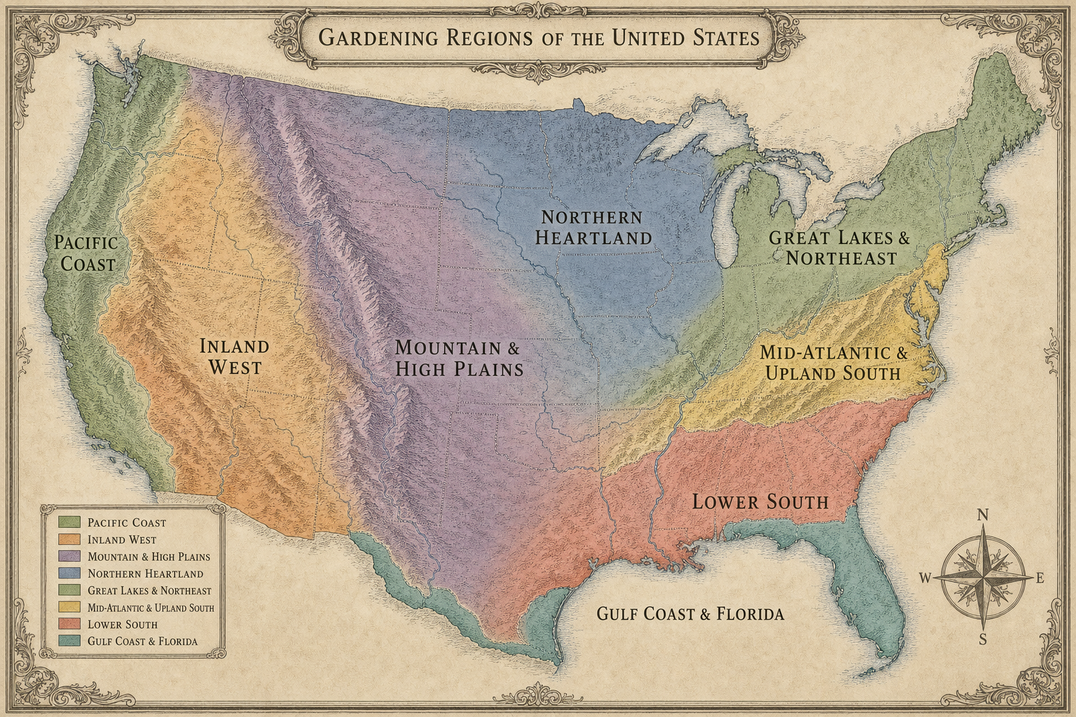
Open full image ↗ National gardening regions
Modern Gardening Regions
Eight broad regions follow climate, hardiness, elevation, and agricultural patterns across the country.
Nate’s Supplemental
Eight regional plates
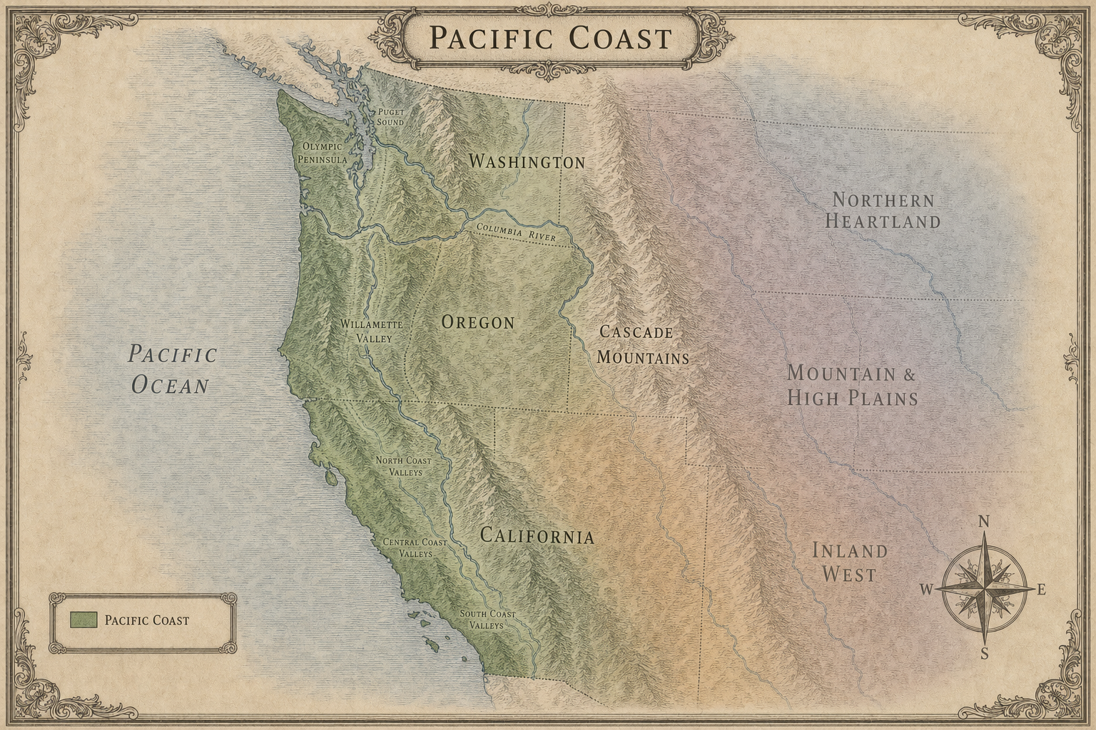
Open full image ↗ Modern regional plate
Pacific Coast
The maritime strip from coastal California through western Oregon and Washington.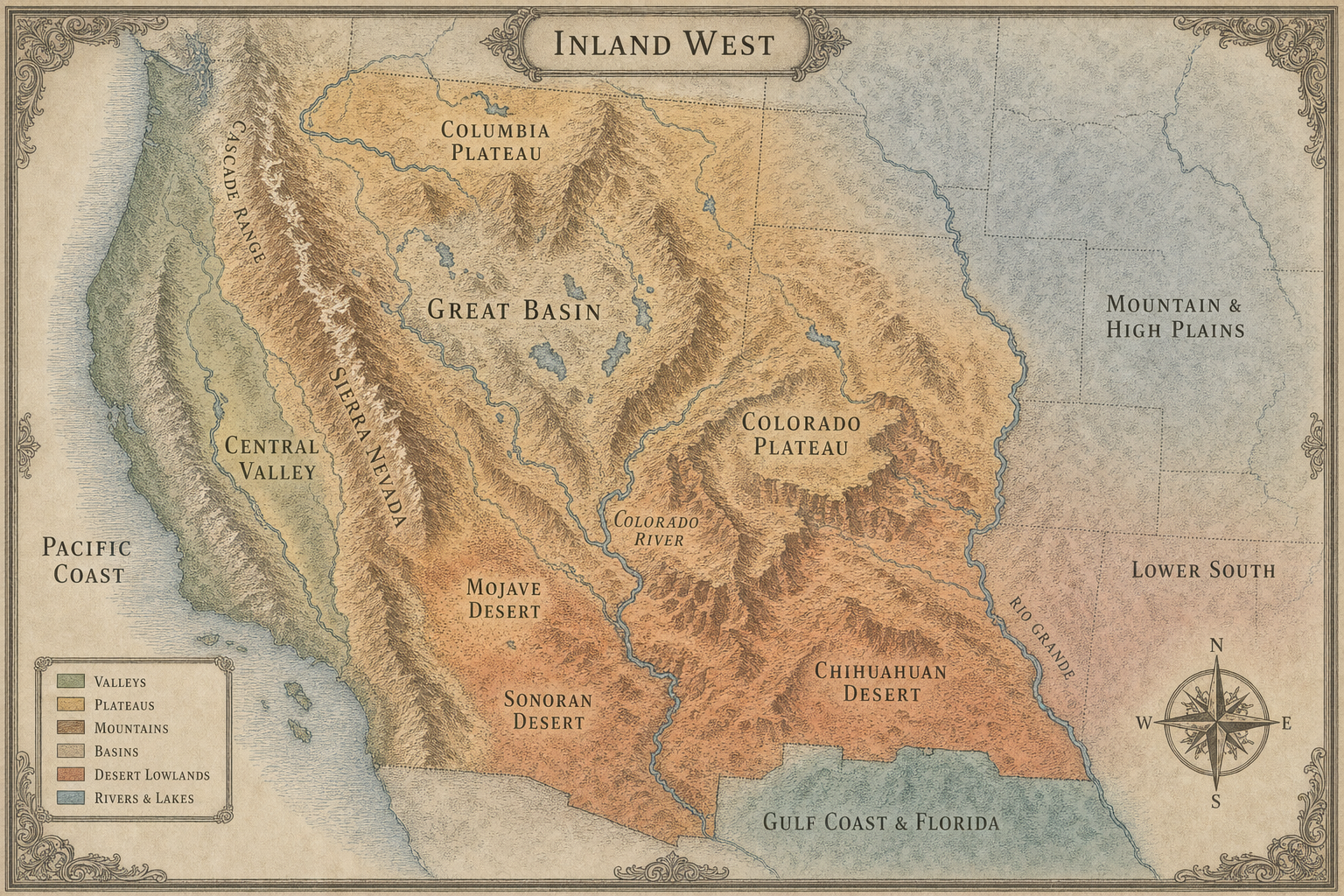
Open full image ↗ Modern regional plate
Inland West
Interior valleys, plateaus, basins, and deserts from California through the Southwest.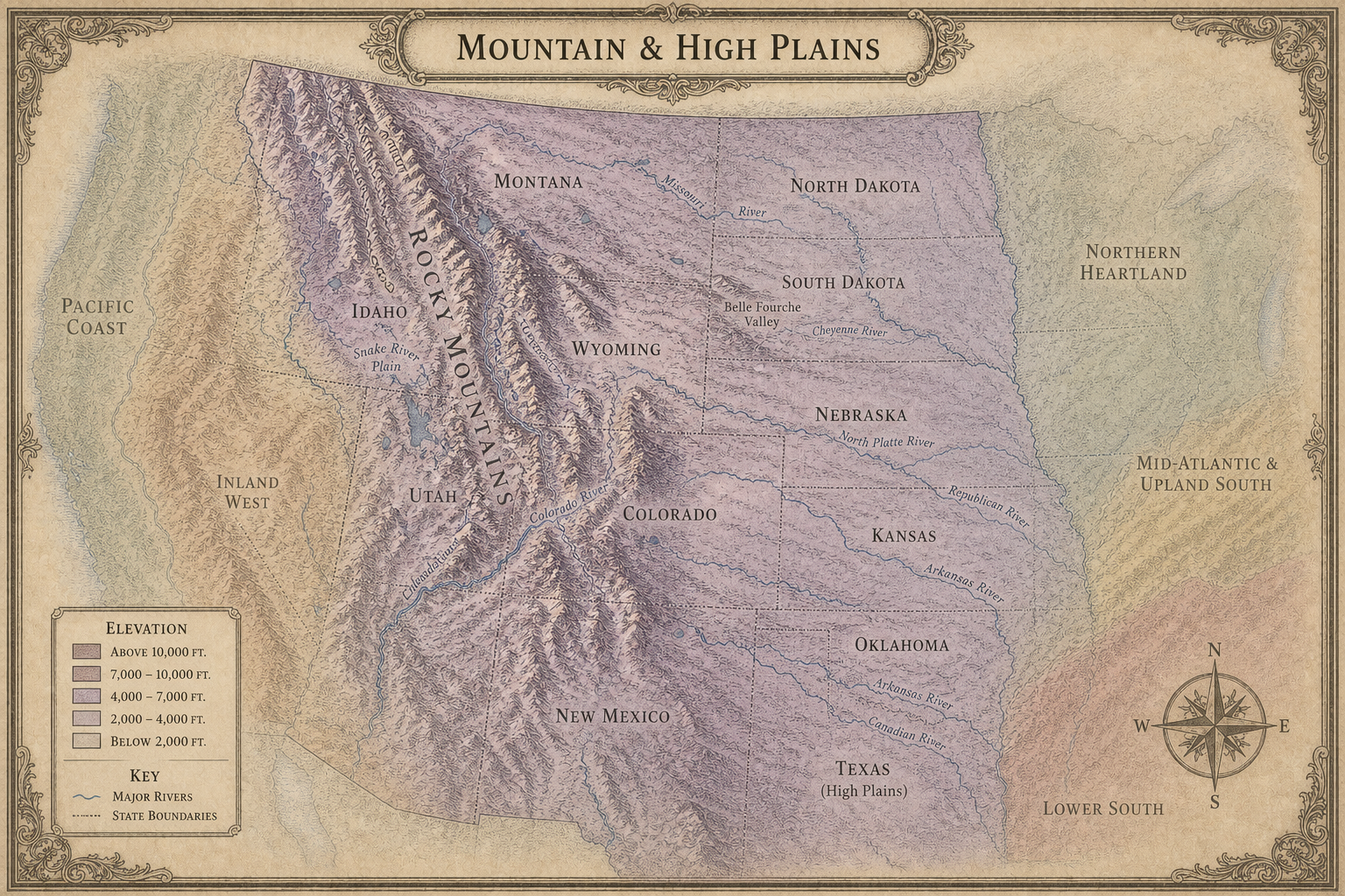
Open full image ↗ Modern regional plate
Mountain & High Plains
The Rocky Mountain spine, high plateaus, and the elevated plains immediately to the east.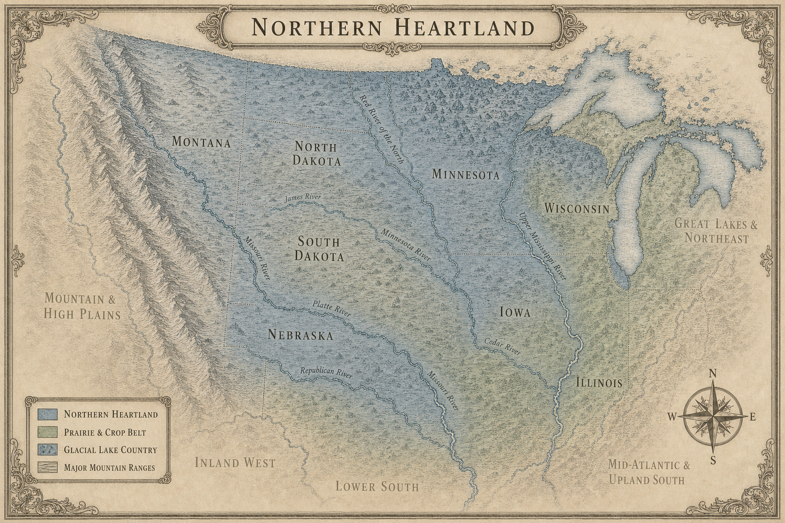
Open full image ↗ Modern regional plate
Northern Heartland
The northern plains, upper Midwest, prairie crop belt, and glacial lake country.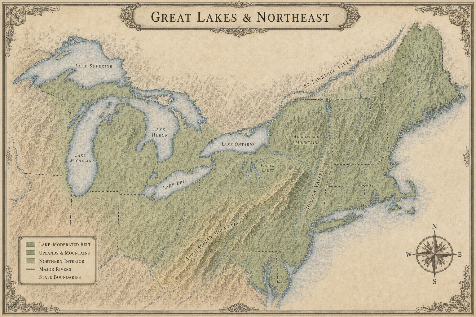
Open full image ↗ Modern regional plate
Great Lakes & Northeast
Lake-moderated country, New York, New England, and the colder northeastern interior.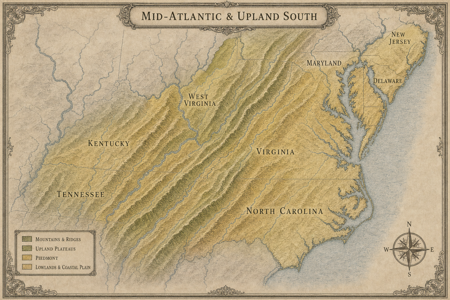
Open full image ↗ Modern regional plate
Mid-Atlantic & Upland South
Chesapeake, Piedmont, Blue Ridge, Appalachian valleys, and neighboring uplands.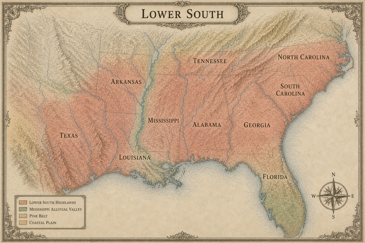
Open full image ↗ Modern regional plate
Lower South
The warm humid inland Southeast, Mississippi Valley, pine belt, and coastal plain transition.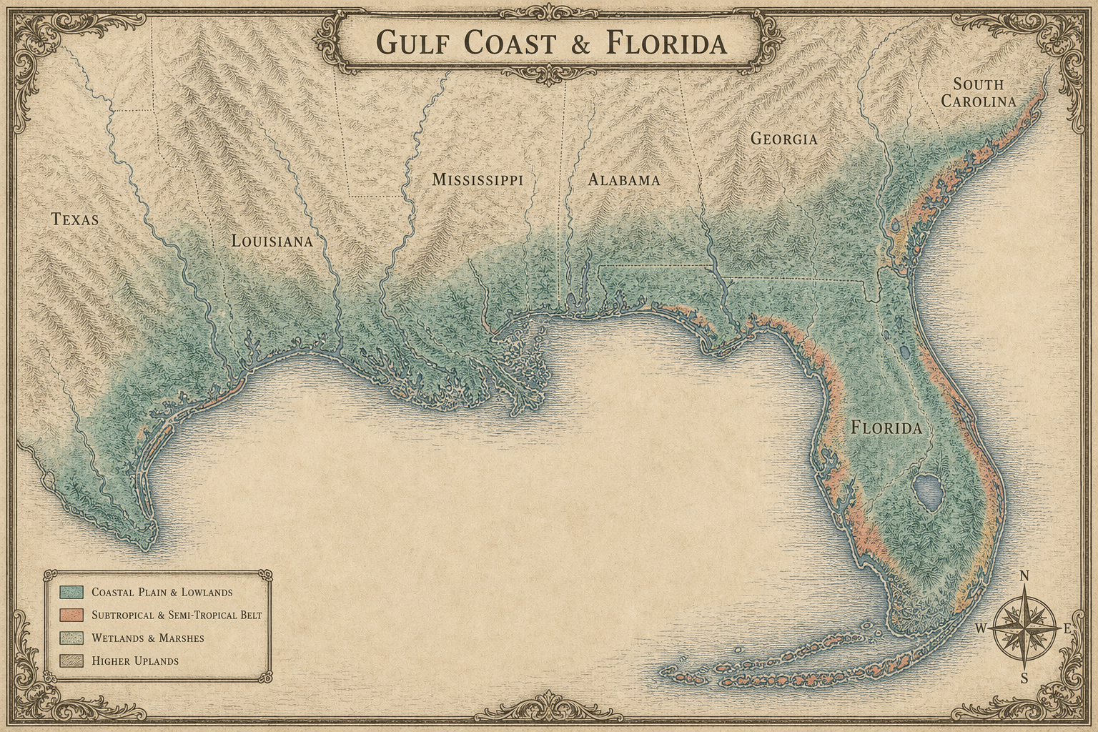
Open full image ↗ Modern regional plate
Gulf Coast & Florida
The subtropical Gulf fringe, coastal wetlands, Florida peninsula, and warm Atlantic coast.